Best Thermal Drones for Aerial Imaging
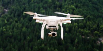
Thermal drones, equipped with thermal imaging cameras, are revolutionizing industries by detecting heat signatures and enabling varied applications. Learn how they work and their benefits.
Thermal drones, equipped with thermal imaging cameras, are revolutionizing industries by detecting heat signatures and enabling varied applications. Learn how they work and their benefits.
Aerial photogrammetry captures detailed geographic data using airborne photography, blending photography, optics, and computing to create accurate maps and 3D models. This technique has evolved since the mid-19th century.
Discover the benefits of drone surveys for industries like construction, agriculture, and real estate. Enjoy efficiency, cost savings, and improved data accuracy with this modern tool.
Hire a professional drone pilot near you to meet the rising demand in commercial and recreational drone use, ensuring quality for diverse projects like real estate and agriculture.
FlyGuys, or FIFO workers, travel to remote locations for industries like mining and construction. They live on-site for periods before home breaks, facing unique rewards and challenges.
Drone mapping services offer cost-effective and efficient solutions, revolutionizing industries that relied on expensive helicopters and planes for surveys. Various types cater to specific needs.
Drones, originally military tools, are now vital in insurance, enhancing damage assessment efficiency and safety by providing high-resolution images and videos quickly and safely.
Drones have revolutionized industries by reaching difficult areas, making inspections easier. Equipped with cameras and sensors, they capture high-resolution data and use GPS for precise tracking.
Autel Evo 2 Pro: Advanced drone with superior 20MP camera offering stunning imagery and versatile performance, perfect for both hobbyists and professionals.
The DJI Mavic 3 Enterprise is a top-tier drone for commercial use, featuring advanced capabilities and robust durability. Explore its design and impressive performance.
Subscribe for Updates
Get the latest articles delivered to your inbox.
We respect your privacy. Unsubscribe anytime.