LiDAR Drone for Sale
LiDAR Drones for Sale: A Comprehensive Guide
Welcome to an exploration of LiDAR drones. These advanced tools are transforming industries by offering precise, fast, and efficient data collection capabilities. Let’s dive into the essential details you should know when seeking a LiDAR drone for sale.

What is LiDAR?
LiDAR stands for Light Detection and Ranging. It uses laser pulses to measure distances. By emitting laser beams and calculating the time it takes for them to bounce back, LiDAR generates detailed, three-dimensional maps of environments.
LiDAR technology is utilized in various fields. Architecture, archaeology, forestry, and autonomous vehicles benefit significantly. It brings accuracy and efficiency, making complex data collection straightforward.
How Do LiDAR Drones Work?
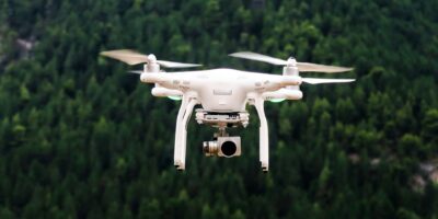
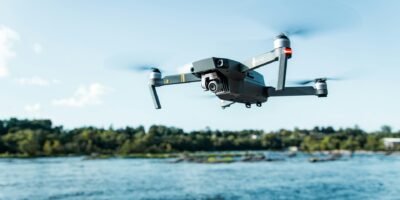
LiDAR drones combine unmanned aerial vehicles (UAVs) with LiDAR sensors. They fly over areas of interest, scanning and collecting data. The captured data is processed to create 3D models and maps.
This integration allows for rapid data acquisition. Drones can access hard-to-reach or hazardous areas effortlessly. The result is detailed terrain and topography mapping, which is crucial for many applications.
Key Benefits of LiDAR Drones
- Accuracy: LiDAR drones provide high-precision data. They capture intricate details of environments, making them ideal for scientific and commercial use.
- Efficiency: These drones cover large areas quickly. Traditional methods are time-consuming; LiDAR drones streamline the process.
- Safety: Drones can access difficult or dangerous areas, minimizing human risk. This is crucial in harsh or unstable environments.
Applications of LiDAR Drones
LiDAR drones have diverse applications, thanks to their ability to capture detailed, accurate data.
- Surveying and Mapping: They are standout tools for topographic surveying. The generated maps and models aid urban planning, construction, and land use management.
- Forestry: LiDAR drones assess vegetation structure and forest biomass. This information supports sustainable resource management and biodiversity conservation.
- Archaeology: LiDAR drones reveal hidden landscapes and structures. Ancient sites covered by vegetation or rugged terrain become visible, aiding historical research.
- Disaster Management: They provide crucial data for disaster response and mitigation. LiDAR drones map affected areas, guiding rescue efforts and infrastructure rebuilds.
Factors to Consider When Buying a LiDAR Drone
Purchasing a LiDAR drone requires careful consideration of several factors to ensure the best fit for your needs.
- Sensor Quality: Ensure the LiDAR sensor meets your resolution and range requirements. Higher-quality sensors provide more detailed data.
- Drone Specifications: Evaluate flight time, payload capacity, and stability. Longer flight times and higher payloads enable extensive data collection without frequent breaks.
- Software Compatibility: Opt for drones compatible with your processing software. Seamless integration between hardware and software simplifies data analysis.
- Cost: Assess your budget. Prices vary significantly based on features and quality. Balance cost with the required functionality.
Popular LiDAR Drones on the Market
Several models stand out in the LiDAR drone market. Here are a few notable options:
- DJI Matrice 600 Pro: A robust drone compatible with multiple LiDAR sensors. Known for its stability and extended flight time.
- RIEGL VUX-1 UAV: Offers high-resolution data. Its lightweight design is perfect for demanding applications.
- Velodyne Lidar Alpha Puck: Provides an extensive range and high point density. Ideal for large-scale mapping projects.
- Microdrones mdLiDAR1000: Integrates seamlessly with its proprietary software. Known for its simplicity and reliability.
Steps to Purchase a LiDAR Drone
Navigate the process of purchasing a LiDAR drone with confidence by following these steps:
- Identify Your Needs: Determine the specific requirements of your projects. Assess what features and capabilities are essential.
- Research Available Options: Compare various models and brands. Look for user reviews and expert opinions.
- Contact Suppliers: Reach out to manufacturers or authorized dealers. Ask questions to clarify any uncertainties.
- Evaluate Support and Training: Ensure the supplier provides adequate training and support. Familiarize yourself with drone operation and maintenance.
- Make the Purchase: Finalize the purchase through trusted vendors. Consider warranty and post-purchase services.
Maintenance and Legal Considerations
Regular maintenance ensures your LiDAR drone remains in optimal condition. Follow manufacturer guidelines for servicing and repairs. Keep software updated to leverage new features and improvements.
Legal considerations are equally important. Ensure compliance with aviation regulations in your area. Obtain necessary permits for LiDAR drone operations. Staying informed about local laws prevents legal complications and ensures safe usage.
Future Trends in LiDAR Drone Technology
The future of LiDAR drone technology holds exciting advancements. Enhanced sensor accuracy and efficiency are on the horizon. Innovations will drive better data quality and faster processing times.
Integration with artificial intelligence will revolutionize data analysis. AI algorithms will automate data interpretation, providing valuable insights. This synergy will broaden the scope of applications, making LiDAR drones more versatile.


