Aerial Photogrammetry: An Overview
Aerial photogrammetry is a technique used to gather precise information about the physical world by taking photographs from an airborne platform. This method utilizes principles from photography, optics, and computing to create detailed maps and 3D models of objects and environments.

Historical Context
The roots of aerial photogrammetry trace back to the mid-19th century when photographers began attaching cameras to balloons and kites. These early attempts set the stage for more advanced methods that followed. By World War I, airplanes equipped with cameras provided valuable reconnaissance data, marking significant strides in the field.
Core Principles
The foundation of aerial photogrammetry lies in its ability to determine spatial relationships from photographic images. Using overlapping images, photogrammetrists can triangulate points in space.
- Two or more images: Aerial photogrammetry relies on capturing multiple images of the same area from different angles.
- Parallax effect: The slight differences in perspective between overlapping images help measure distances.
- Control points: Known coordinates on the ground are used to stabilize and scale photographic data.
Modern Techniques and Tools
Modern aerial photogrammetry benefits from advancements in both aerial platforms and imaging technology. Drones, aircraft, and satellites serve as platforms, each offering unique advantages.
Light Detection and Ranging (LiDAR) systems supplement traditional photographic methods, providing high-resolution data. This combination enhances accuracy and detail.
The Role of Drones
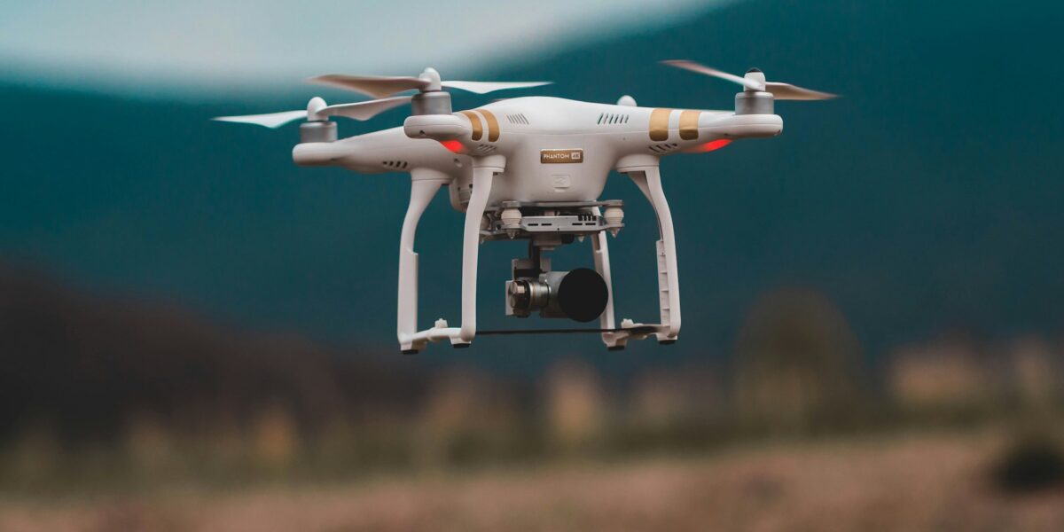
Drones have revolutionized aerial photogrammetry. Equipped with high-resolution cameras and GPS systems, drones capture detailed images over large areas efficiently.
- Accessibility: Drones are cost-effective and easy to deploy compared to manned aircraft.
- Precision: Advanced GPS and stabilization technology allow for high-precision data collection.
- Flexibility: Drones can navigate difficult terrains and capture images from low altitudes.
Data Processing
Processing aerial photogrammetry data involves several steps. Software applications play a crucial role in interpreting and modeling the data.
- Image stitching: Combining multiple images into a cohesive dataset.
- Orthorectification: Correcting image distortions caused by terrain variations and camera angles.
- 3D modeling: Using overlapping images to create detailed three-dimensional representations.
Popular software tools in the industry include Pix4D, Agisoft Metashape, and DroneDeploy.
Applications
Aerial photogrammetry offers significant advantages across various industries. Some notable applications include:
- Mapping and Surveying: Creating accurate topographic maps and property boundaries.
- Construction: Monitoring project progress, site inspections, and volumetric measurements.
- Agriculture: Analyzing crop health, soil conditions, and irrigation needs through precision agriculture.
- Environmental Monitoring: Assessing changes in land use, deforestation, and natural disaster impacts.
- Urban Planning: Facilitating city planning, infrastructure development, and transportation projects.
Accuracy and Precision
The accuracy of aerial photogrammetry depends on several factors. High-resolution sensors, precise control points, and rigorous data processing are critical components. Ground control points (GCPs) improve the georeferencing of aerial images, ensuring higher accuracy.
Advancements in artificial intelligence and machine learning also contribute to improved data analysis and error reduction, enhancing the reliability of photogrammetric outputs.
Challenges and Limitations
Despite its advantages, aerial photogrammetry faces certain challenges. Weather conditions, for instance, can impact data collection. Cloud cover, rain, and strong winds may hinder aerial operations.
Processing large datasets demands significant computational resources and expertise. Proper calibration of cameras and sensors is vital to ensure data quality.
Regulatory restrictions on UAV flights in certain areas can limit the deployment of drones for photogrammetry. Compliance with aviation regulations is mandatory for safe and legal operations.
Future Trends
The future of aerial photogrammetry looks promising with ongoing advancements in technology. Improvements in drone battery life, sensor accuracy, and data processing algorithms are anticipated. Enhanced AI capabilities will further streamline data analysis processes, yielding quicker and more accurate results.
The integration of photogrammetry with other geospatial technologies, such as GIS and remote sensing, will provide holistic insights into complex spatial problems.
The use of aerial photogrammetry in autonomous vehicles for navigation and environment mapping is another exciting development on the horizon.
Case Studies
Several real-world applications highlight the transformative potential of aerial photogrammetry. For instance, after natural disasters, photogrammetry helps assess damage and aids in recovery efforts. In agriculture, farmers can optimize yield by analyzing aerial imagery of their fields.
Educational and Training Resources
Learning aerial photogrammetry involves understanding both theoretical principles and practical applications. Numerous universities and online platforms offer courses and certifications in this field. Tutorials, forums, and user communities provide valuable support and resources for ongoing learning.
Workshops and seminars conducted by industry experts offer hands-on experience with the latest tools and techniques, fostering practical skills and knowledge.
Conclusion
Aerial photogrammetry stands as a pivotal tool in modern mapping and data analysis. Its ability to capture and interpret spatial information accurately has broad applications, ranging from construction to environmental monitoring. With ongoing advancements in technology, the scope and precision of this field will continue to evolve.


