Lidar in Archaeology
Lidar in Archaeology
Lidar, which stands for Light Detection and Ranging, is revolutionizing the field of archaeology. It uses laser light to measure distances. This technology offers greater precision compared to traditional surveying methods. An aircraft or drone equipped with a lidar sensor emits laser beams toward the ground. These beams bounce back to the sensor, providing detailed information about the landscape. The result is a high-resolution, three-dimensional map.

Advantages of Lidar
Lidar can penetrate dense forest canopies. Traditional survey methods struggle in such environments. Rainforests, for example, have thick vegetation that obscures ground features. Lidar’s laser pulses can pass through small gaps in the canopy. This makes it possible to detect hidden structures or landscapes beneath.
It also offers speed and efficiency. Large areas can be surveyed in a short time. This is especially beneficial for archaeologists working on tight schedules or limited budgets. It’s not just about speed; the accuracy is remarkable. It provides detailed topographical data that would be hard to gather by hand.
Applications in Archaeology
Lidar is used to discover lost cities. In Honduras, for example, lidar revealed ruins in the Mosquitia rainforest. It uncovered a site believed to be the legendary White City. Archaeologists walked the terrain to verify lidar findings. They discovered plazas, pyramids, and even irrigation canals.
Lidar also helps map large-scale ancient landscapes. In Cambodia, it exposed the vast urban network surrounding Angkor Wat. This network included highways, water reservoirs, and settlements. These features had remained hidden beneath tropical vegetation.
How Lidar Works
The lidar system emits laser pulses towards the ground. It measures the time it takes for each pulse to return. The system calculates distances based on the time delay. Multiple pulses create a dense grid of data points. These points are then used to generate a detailed map.
- Laser pulses are sent out and returned.
- Distance is calculated using the time delay.
- Data points form a dense grid.
- Software translates these points into a map.
Lidar can capture up to hundreds of thousands of data points per second. This results in a comprehensive and highly detailed map.
Challenges and Limitations
Lidar is sensitive to certain environmental factors. Heavy rain and thick clouds can interfere with laser pulses. This can reduce data accuracy. Also, lidar equipment and processing software are costly. Not all archaeological projects can afford these expenses.
Interpreting the data requires expertise. It’s not always easy to distinguish between natural and man-made features. Training and experience are essential to make accurate interpretations.
Future Prospects
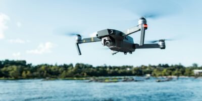
The technology continues to evolve. Advances in lidar are likely to reduce costs. This will make it more accessible to smaller projects. Portable and lightweight sensors are also in development. These can be mounted on drones, making it easier to survey remote areas.
Artificial Intelligence (AI) is being integrated with lidar data. AI can help interpret complex datasets. This combination could make the analysis faster and more accurate.
Open-source software is becoming more available. This helps advance the use of lidar by providing accessible tools for data processing.
Case Studies
Cambodia’s Angkor Wat
Researchers used lidar to study Angkor Wat and its surroundings. The survey covered over 370 square miles. It revealed a complex urban network. This network included roads, canals, and previously unknown temples. The findings provided new insights into the Khmer Empire’s city planning and infrastructure.
Mayan Civilization in Guatemala
In Guatemala, lidar uncovered 60,000 previously unknown Maya structures. These included houses, palaces, and defense works. The survey covered over 800 square miles in northern Guatemala. These discoveries have reshaped the understanding of Mayan civilization. It showed that the region was far more densely populated than previously thought.
Caracol, Belize
Caracol is a major ancient Maya city in Belize. Lidar mapping revealed extensive agricultural terraces and irrigation systems. It also uncovered a vast network of causeways. These findings suggest Caracol was a highly organized urban center. It provided insights into the city’s economy and social structure.
Tools and Techniques
Lidar systems vary in complexity. Airborne lidar systems are mounted on planes or helicopters. They are ideal for covering large areas quickly. Terrestrial laser scanning (TLS) is another approach. These systems are ground-based and offer higher-resolution data for smaller areas.
Lidar Components
- Laser emitter: Generates laser pulses.
- GPS receiver: Provides geographical coordinates for data points.
- Inertial Measurement Unit (IMU): Measures the orientation of the sensor.
- Data storage: Collects the raw data for later processing.
These components work together to ensure accurate data collection. The GPS and IMU help georeference the data points, aligning them correctly on maps.
Data Processing
Processing lidar data involves several steps. First, the raw data is collected. This data is then filtered to remove noise and irrelevant points. Algorithms help identify ground points from vegetation or structures. The cleaned data is used to create digital models of the terrain.
Various software programs are available for processing. LAStools and TerraScan are popular choices. These tools help streamline the workflow and ensure accurate results.
Impact on Archaeology
Lidar has significantly impacted archaeological methods. It allows for non-invasive exploration, preserving sites for future study. There’s also greater focus on landscape archaeology. This discipline looks at entire regions rather than individual sites. Lidar data supports this approach by providing high-resolution topographical maps.
The technology also democratizes access to data. Shared lidar datasets enable collaborative research. Multiple experts can work on the same data, offering different interpretations or insights.


