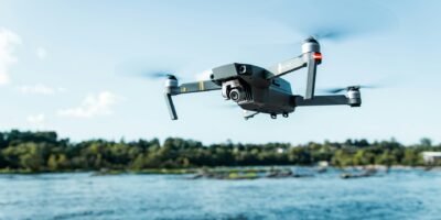
DJI Phantom 4 RTK
DJI Phantom 4 RTK
The DJI Phantom 4 RTK represents a significant advancement in drone technology. It integrates high-precision RTK positioning, allowing for centimeter-level accuracy. Designed primarily for surveyors, mappers, and GIS professionals, this drone stands out due to its ability to deliver high accuracy with less ground control points.

The Phantom 4 RTK comes with a new RTK module integrated directly into the drone. This module provides real-time, high-precision data to the onboard systems, ensuring accurate results. The RTK module is complemented by the TimeSync system, which ensures the major components like the flight controller, camera, and RTK module are in sync. The TimeSync system ensures each photo uses the most accurate metadata and fixes the positioning data to the center of the CMOS sensor.
Flight performance continues to be impressive with the Phantom 4 RTK. The drone maintains a similar shape to the Phantom 4 Pro, ensuring easy familiarity for those who have used DJI’s Phantom series before. It features a 20-megapixel CMOS sensor which can capture high-resolution images. The mechanical shutter eliminates rolling shutter distortions. This is essential for the accuracy required in surveying and mapping.
Using the DJI GS RTK App, you can plan missions using the drone’s adaptable capabilities. This app provides a range of intelligent flight modes, including Photogrammetry, Waypoint Flight, Terrain Awareness, and more. The integration of OcuSync ensures stable and reliable image transmission. It can deliver a 1080p HD video feed over a range of up to 7 km, though local regulations and conditions may affect this range.
The drone’s flight autonomy and safety features stand out. The aircraft’s dual compass modules and dual IMUs provide redundancy in the system. If one sensor fails, the other takes over, ensuring stable flight. The primary flight controller is extremely reliable, interpreting data accurately to make informed decisions during flight.
Users should take note of the battery life. With a maximum flight time of approximately 30 minutes, the Phantom 4 RTK provides sufficient time for most missions. The drone uses Intelligent Flight Batteries that monitor current power levels to prevent sudden power loss during flight.
The Phantom 4 RTK is suited for a range of applications. In construction, it is used for site surveying and volumetric measurements. Its accurate data collection allows professionals to make precise calculations about materials and space. In agriculture, the drone aids in field mapping and crop monitoring, providing a detailed view of conditions. Mining operations use the Phantom 4 RTK for stockpile measurements and general site management.
Integrating the drone into GIS workflows is straightforward. The DJI Terra software simplifies the mapping process, enabling the creation of 2D orthomosaic maps and 3D models. These maps and models integrate well with existing GIS platforms, enhancing data processing and analysis.
The drone features enhanced data security measures. With password protection on the remote controller, unauthorized users are prevented from accessing drone settings and data. The drone’s local data mode ensures that flight data is only saved locally, reducing the risk of remote data breaches.
Data transfer is facilitated through microSD cards. The Phantom 4 RTK supports microSD cards up to 128GB, allowing users to store large volumes of data. This capability is particularly important when conducting extensive surveys that require numerous high-resolution images.
Several accessories enhance the drone’s functionality. The DJI D-RTK 2 Mobile Station can provide highly accurate differential data in real time. The station broadcasts this data to the drone, further improving positional accuracy. Other accessories include additional Intelligent Flight Batteries, propeller sets, and carrying cases for transport and storage.
The Phantom 4 RTK integrates well with third-party software. Many GIS and photogrammetry programs support the drone, ensuring seamless data processing and analysis. Users benefit from the compatibility, allowing for custom workflows tailored to specific project needs.
Key Specifications
- RTK Module: Integrated, providing centimeter-level accuracy
- Camera: 20MP CMOS sensor with mechanical shutter
- Maximum Flight Time: Approximately 30 minutes
- Transmission System: OcuSync, HD video feed up to 7 km
- Battery: Intelligent Flight Battery (5870 mAh)
Applications
- Construction: Site surveying, volumetric measurements
- Agriculture: Field mapping, crop monitoring
- Mining: Stockpile measurements, site management
The DJI Phantom 4 RTK offers significant advancements for professionals in various fields. Its high-precision RTK positioning, integrated camera, and robust flight features make it a critical tool for surveying, mapping, and data collection.

