Understanding UAS Sensors
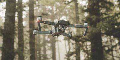
Unmanned Aerial Systems (UAS), commonly known as drones, have seen extensive use across various industries. A pivotal component of these systems are the sensors installed on them. These sensors gather data necessary to perform diverse tasks, from agriculture to infrastructure inspection.

Types of Sensors Used in UAS
UAS typically come equipped with a range of sensors. Each sensor has a specific role, contributing to the UAS’s overall capability. The following are commonly used sensors in drones:
- Camera Sensors: These sensors capture high-resolution images and videos. They are essential for tasks like aerial photography, surveillance, and cinematography. Different cameras, such as thermal or infrared, expand the range of applications.
- LIDAR: LIDAR stands for Light Detection and Ranging. It uses laser pulses to measure distances. LIDAR is crucial for creating precise 3D models of landscapes and structures. This makes it valuable for mapping, archaeology, and forestry.
- Radar Sensors: Radars detect objects and determine their range, angle, or speed. Drones use radar sensors for obstacle avoidance and navigation. They are particularly useful in low-visibility conditions.
- GPS: Global Positioning System sensors are fundamental for navigation. They provide location data, enabling precise flight paths essential for applications like parcel delivery and surveying.
- IMUs: Inertial Measurement Units measure force, angular rate, and magnetic fields. The data helps stabilize the drone, ensuring accurate positioning and smooth movements during flight.
Applications of UAS Sensors
The choice and combination of UAS sensors depend on the intended application. Here are a few popular applications and the sensors that facilitate them:
- Agriculture: NDVI (Normalized Difference Vegetation Index) sensors assess crop health by analyzing reflected light. Multispectral cameras are crucial in monitoring nutrient levels and water needs.
- Construction and Infrastructure Inspection: LIDAR and high-resolution cameras aid in surveying sites and inspecting structural integrity. UAS provide up-to-date mapping essential for progress tracking and safety assessments.
- Environmental Monitoring: Drones equipped with air quality sensors collect data on pollutants. Thermal sensors help in monitoring wildlife and detecting forest fires.
- Emergency Response: Infrared cameras can locate people in search and rescue operations. Drones can access areas that are hard to reach, providing real-time data to operators.
- Public Safety and Law Enforcement: Camera and thermal sensors assist in crowd monitoring and situational awareness. UAS can cover large areas quickly, making them invaluable in emergency situations.
Technical Challenges and Considerations
Utilizing sensors on UAS involves overcoming several technical challenges. Power consumption is a significant concern as sensors, especially LIDAR and radar, require substantial energy. This impacts flight duration and payload capacity. Data processing and storage are also critical. High-resolution imagery and LIDAR point clouds generate vast amounts of data, necessitating efficient onboard processing capabilities or high-bandwidth data links.
Sensor calibration and integration pose additional hurdles. Accurate data collection relies on precisely calibrated sensors. Misalignment or miscalibration leads to errors in data interpretation. Ensuring compatibility between sensors can be complex. Integration issues may arise with sensors from different manufacturers due to varying communication protocols or power requirements.
Regulatory Environment and Safety
Operating drones equipped with sensors falls under regulatory scrutiny. Authorities like the FAA in the United States establish guidelines for drone operation. These include restrictions on flying near airports or in populated areas without proper authorization. Compliance is critical to ensure safety and maintain the integrity of collected data. UAS operators must understand regulations concerning data privacy. Camera-equipped drones can inadvertently capture personal or proprietary information, leading to legal challenges.
The Future of UAS Sensors
The evolution of UAS sensors is far from over. Advances in technology promise enhanced capabilities. Miniaturization and improved efficiency will lead to lighter, more energy-efficient sensors. Artificial intelligence and machine learning integration allow for better data analysis, leading to smarter and more adaptable drones.
Wireless technology will play a role in future developments. Better communication systems will improve remote control and data transfer capabilities. This opens avenues for more autonomous operations and advances in swarm technology, where multiple drones work in conjunction.
Sustainability will influence future sensor development. The industry is looking towards greener technologies, focusing on reducing the environmental footprint of both the sensors and UAS as a whole.
Recommended Aviation Gear
David Clark H10-13.4 Aviation Headset – $376.95
The industry standard for aviation headsets.
Pilots Handbook of Aeronautical Knowledge – $25.42
Essential FAA handbook for every pilot.
As an Amazon Associate, we earn from qualifying purchases.


