Drone Mapping Services
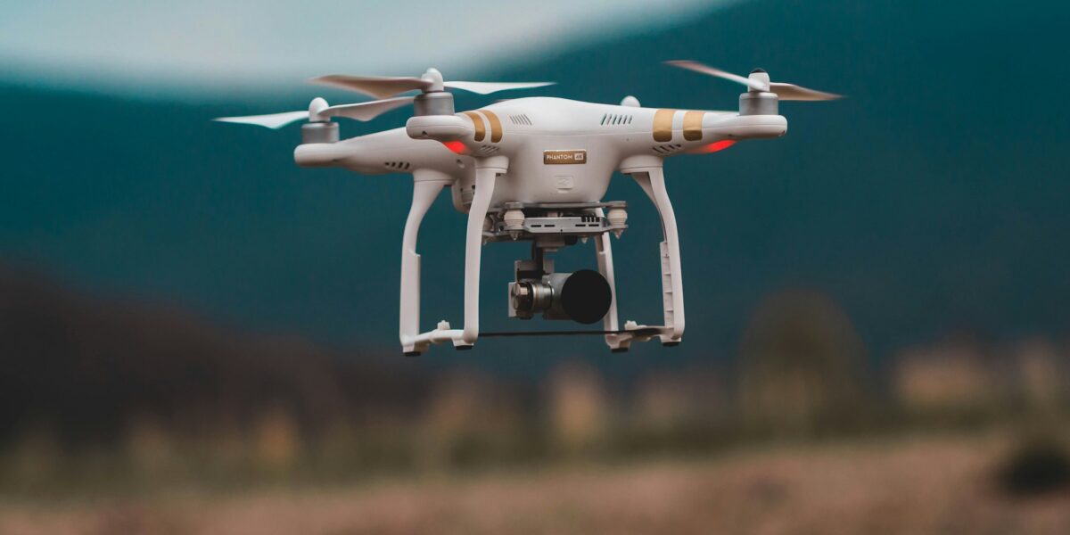
Drones have revolutionized industries that require mapping and surveying. They provide cost-effective and efficient solutions. Before drones, aerial surveys relied on helicopters and planes, which were expensive and had limitations. With drones, mapping is accessible to more industries and at a fraction of the cost.

Types of Drone Mapping
Drone mapping can be divided into several categories. Each caters to specific industry needs. Here’s a look at the most common types:
- Photogrammetry
- LiDAR
- 3D modeling
- Thermal mapping
Photogrammetry
Photogrammetry involves taking overlapping photographs of an area and stitching them together to create a map or 3D model. This method is ideal for creating accurate and detailed maps. The drones capture high-resolution images which are then processed using specialized software.
LiDAR
LiDAR uses lasers to measure distances and create detailed 3D representations of the terrain. It is particularly useful in forestry, agriculture, and construction. Unlike photogrammetry, LiDAR can penetrate through vegetation, providing an accurate ground model even in dense forests.
3D Modeling
3D modeling with drones combines photogrammetry and LiDAR. This creates even more comprehensive models of landscapes and structures. These models are invaluable for urban planning, real estate, and mining.
Thermal Mapping
Thermal mapping uses infrared cameras to capture temperature data. This type of mapping is useful for identifying heat leaks in buildings, monitoring livestock health, and detecting forest fires. The thermal images provide insights that are not visible to the naked eye.
Applications of Drone Mapping Services
Drone mapping finds applications in a wide range of industries. The following sections detail some of these applications.
Agriculture
In agriculture, drone mapping helps monitor crop health, manage irrigation, and plan for planting. Drones provide data on plant health using NDVI (Normalized Difference Vegetation Index). Farmers can identify issues like pest infestations and nutrient deficiencies.
Construction
Construction sites benefit from drone mapping through site surveys, progress monitoring, and safety inspections. Detailed maps allow project managers to make informed decisions. Drones can survey large areas quickly, providing accurate data that helps maintain project timelines.
Environmental Conservation
Conservationists use drone mapping to monitor wildlife, track deforestation, and study ecosystems. Drones provide a non-intrusive way to collect data. They help in creating detailed maps of inaccessible areas, aiding in the protection and management of natural resources.
Urban Planning
Urban planners use drones to survey land, plan roads, and design infrastructure. High-resolution maps assist in making data-driven decisions. This is particularly useful in rapidly growing cities where accurate, up-to-date information is crucial.
Mining
Mining operations use drone mapping for site surveys, volume calculations, and safety inspections. Drones provide an efficient way to survey large, often hazardous, areas. This helps in creating accurate maps and models for planning and operational purposes.
Real Estate
Real estate developers use drone mapping to create detailed property maps, plan developments, and monitor progress. High-resolution imagery and 3D models enhance property presentations and marketing efforts, offering potential buyers a comprehensive view of the properties.
Benefits of Drone Mapping
Drone mapping offers numerous benefits over traditional methods. Here are some of the key advantages:
- Cost-Effective
- Time-Saving
- High Accuracy
- Safety
- Accessibility
Cost-Effective
Traditional aerial surveys require significant financial investment. Drones reduce costs by eliminating the need for manned aircraft and reducing labor costs. This makes mapping services accessible to smaller businesses and organizations.
Time-Saving
Drone mapping significantly reduces the time required to survey large areas compared to ground-based methods. Drones can cover extensive areas in a fraction of the time, providing quick access to critical data.
High Accuracy
Drones equipped with advanced sensors and GPS technology provide highly accurate data. This accuracy is crucial for industries such as construction, where precise measurements are necessary for planning and progress tracking.
Safety
Drones can operate in hazardous environments without putting human lives at risk. In industries like mining and construction, drones can perform inspections and surveys in areas that are dangerous for humans to access.
Accessibility
Drones can access remote and difficult-to-reach areas. This capability is beneficial in environmental conservation and agriculture, where it is often challenging to collect data through traditional means.
Challenges in Drone Mapping
Despite numerous advantages, drone mapping faces several challenges. These include regulatory hurdles, technical limitations, and environmental factors.
Regulatory Issues
Operating drones requires adherence to stringent regulations. These rules vary by country and often involve restrictions on flight altitudes, no-fly zones, and licensing requirements. Ensuring compliance can be time-consuming and complicated.
Technical Limitations
Drones have limitations in terms of battery life, payload capacity, and data processing. Battery life restricts the flight time, necessitating multiple flights for large areas. The payload capacity limits the types and number of sensors that can be used simultaneously.
Environmental Factors
Weather conditions such as wind, rain, and fog can impact drone operations. These factors can limit the ability to capture accurate data. Additionally, drones may face challenges in densely vegetated or built-up areas where GPS signals can be obstructed.
Future of Drone Mapping
As technology advances, the capabilities and applications of drone mapping will continue to expand. Improvements in battery technology, sensors, and data processing will address some current limitations. Here are a few trends to watch for:
Automation
Automation in drone operations will increase efficiency. Autonomous drones can perform pre-programmed flight missions, minimizing the need for human intervention. This automation will allow for more frequent and consistent data collection.
Enhanced Data Analytics
Advancements in AI and machine learning will enhance data analysis from drone surveys. These technologies will provide deeper insights and predictive analytics, aiding in decision-making processes across various industries.
Integration with Other Technologies
Drone mapping will increasingly integrate with other technologies such as IoT devices and geospatial information systems (GIS). This integration will provide comprehensive, real-time data for applications like smart city planning and precision agriculture.
Broader Accessibility
As costs continue to decrease and technology becomes more user-friendly, drone mapping services will become even more accessible to smaller businesses and individual users. This democratization of technology will spur innovation and new uses across industries.
Drone mapping services are transforming how industries approach mapping and surveying tasks. With continuing advancements in technology and increasing accessibility, the future of drone mapping holds exciting potential for innovation and efficiency.

