Volume Measurement with Drones
Volume Measurement with Drones
Drones have revolutionized many industries, including surveying, agriculture, and construction. One significant application is volume measurement. This technique helps in calculating the volume of stockpiles, excavation sites, and other areas where traditional methods are time-consuming and inaccurate.

Understanding the Basics
Volume measurement with drones involves capturing aerial images of the target area. The drone flies over the site, taking a series of overlapping photographs. These images are then processed using photogrammetry software to create 3D models. These models provide accurate volume calculations.
Equipment Required
Several components are crucial for volume measurement with drones:
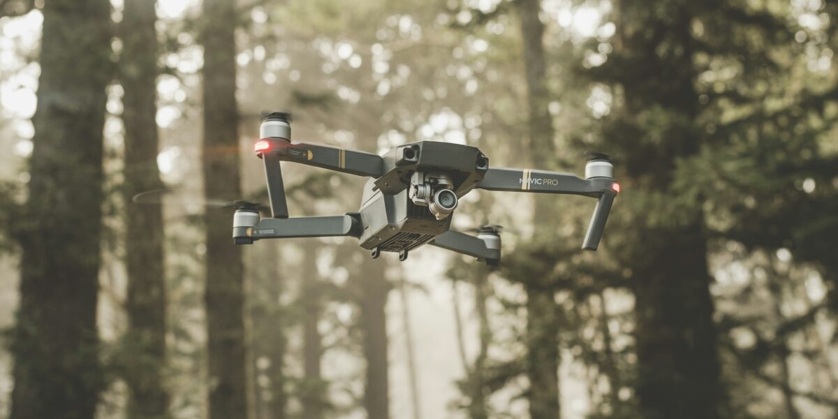
- Drone – A UAV (Unmanned Aerial Vehicle) equipped with a high-resolution camera.
- Camera – Typically, a consumer-grade camera can suffice, but professional-grade cameras offer better accuracy.
- Flight Planning Software – This software helps in planning the drone’s flight path to capture the necessary images.
- Photogrammetry Software – Software like PIX4D or DroneDeploy processes the images to create 3D models.
Flight Planning
Before taking off, flight planning is critical. Define the area to be surveyed and set the flight parameters, including altitude, speed, and image overlap. Higher altitude covers larger areas but may reduce accuracy. Ensure sufficient overlap (usually 70-80%) between images to create detailed 3D models.
Image Acquisition
With the flight plan in place, the drone is ready to capture images. Automation in drones allows them to follow the predetermined flight path, ensuring consistency in data collection. Avoid flying during extreme weather conditions to prevent data distortion.
Data Processing
Once images are captured, they are imported into photogrammetry software. The software stitches the images together, creating a point cloud. This point cloud is a dense collection of data points representing the target area’s surface. The software then converts the point cloud into a 3D model. You can analyze this model for volume measurement.
Volume Calculation Methods
Various methods are available for volume calculation within photogrammetry software:
- Cut and Fill – This method calculates the volume of material added or removed from the site by comparing the current and original surface levels. Useful for excavation and land preparation projects.
- Stockpile – This method calculates the volume of loose materials like gravel, sand, or coal. The software identifies the stockpile boundaries and measures the volume within.
- Triangulated Irregular Network (TIN) – This method creates a network of triangles from the 3D model’s vertices. The volume is calculated by summing the volumes of these individual triangles. It provides accurate results for irregular surfaces.
Accuracy Factors
Several factors influence the accuracy of volume measurements:
- Camera Quality – Higher resolution cameras capture more detailed images, resulting in more accurate models.
- Flight Altitude – Lower altitude provides more detail but covers less area. Balance the altitude to match the project requirements.
- Ground Control Points (GCPs) – GCPs enhance accuracy by serving as reference points for image alignment. More GCPs improve the model’s accuracy.
- Image Overlap – Ensure 70-80% overlap between images to avoid gaps in the model.
Applications in Various Industries
Volume measurement with drones is beneficial in several industries:
- Mining – Accurate volume measurements for stockpiles and excavation sites, aiding inventory management and project planning.
- Construction – Calculating earthworks and materials needed for construction projects. Time-saving and precise compared to traditional methods.
- Agriculture – Estimating the volume of irrigation ponds and reservoirs. Useful for water resource management.
- Environmental Studies – Monitoring changes in landscapes and natural features, such as erosion and sediment displacement.
Advantages of Using Drones for Volume Measurement
The use of drones for volume measurement offers several advantages:
- Efficiency – Faster data collection compared to traditional methods.
- Accuracy – High-resolution images and advanced software provide precise measurements.
- Safety – Reduces the need for personnel to work in hazardous environments.
- Cost-Effective – Lower operational costs with reduced labor and equipment requirements.
- Flexibility – Can survey hard-to-reach areas and large sites in a single flight.
Challenges and Limitations
While beneficial, drone-based volume measurement also has challenges:
- Weather Dependency – Adverse weather can affect flights and data quality.
- Regulatory Restrictions – Drone operations are subject to local aviation regulations, which may limit flight paths and areas.
- Initial Costs – High initial investment for drones and software can be a barrier for small businesses.
- Data Processing Time – Large volumes of data require significant processing time and computing power.
Future Developments
Advancements in drone technology and photogrammetry software are ongoing. Expect improvements in camera resolution, flight automation, and AI-based data processing. These developments will enhance the accuracy, efficiency, and accessibility of drone-based volume measurement.


