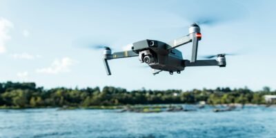
Best Drone for Land Surveying
Best Drone for Land Surveying
Land surveying has been revolutionized by the introduction of drones. These aerial devices offer precise and efficient methods to gather data. Selecting the best drone for land surveying depends on various factors such as camera quality, flight time, and ease of use.

Matrice 300 RTK
The Matrice 300 RTK is a leading choice for professional land surveyors. It offers a remarkable 55-minute flight time, which is critical for covering large areas. The drone is equipped with the Zenmuse P1 camera, known for its high accuracy and detailed images. The integration with RTK technology ensures centimeter-level precision. This makes it highly reliable for tasks that demand extreme accuracy.
Phantom 4 RTK
Phantom 4 RTK combines ease of use with professional capabilities. Its compact design makes it portable while maintaining high functionality. The drone offers a 30-minute flight time, sufficient for many surveying tasks. The RTK module ensures improved accuracy, reducing the need for ground control points. The mechanical shutter on its camera helps in capturing sharp images devoid of distortion, making it ideal for mapping and photogrammetry.
eBee X
eBee X by senseFly is known for its lightweight, fixed-wing design. This drone is built for extended missions, offering a maximum flight time of 90 minutes. Its ability to cover vast areas makes it suitable for large-scale land surveying projects. The senseFly Corridor mapping system enhances its efficiency in collecting data. The eBee X supports various payloads, allowing flexibility in capturing different types of data.
DJI Mavic 2 Pro
DJI Mavic 2 Pro is a versatile option for surveyors who require both functionality and portability. It features a 20MP camera with a 1-inch CMOS sensor that ensures high-quality images. Flight time is around 31 minutes, allowing ample duration for surveying. The drone’s compact size and foldable design help in easy transportation and quick deployment. Though not RTK equipped, it can still perform well with appropriate software integration.
Parrot Anafi USA
Parrot Anafi USA stands out with its 32x zoom and thermal imagery capabilities. Designed for robustness, it operates efficiently in various weather conditions. It has a 32-minute flight time, which is workable for moderate surveying needs. The Advanced Data Security feature ensures that the data collected remains protected. Its ease of use makes it a good entry-level option for consultants and smaller firms.
Key Factors in Choosing a Surveying Drone
Camera Quality
The camera quality directly affects the accuracy and detail of the survey. High-resolution cameras capture more details, crucial for creating accurate maps and models. Mechanical shutters prevent image distortion, a common issue when capturing moving scenes.
Flight Time
Flight time determines how long a drone can stay airborne on a single charge. Longer flight times reduce the frequency of battery changes and increase productivity. For large areas, drones with extended flight times are more efficient.
RTK Technology
Real-Time Kinematic (RTK) technology enhances the positional accuracy of the drone. This is particularly important in surveying where precision is key. RTK-enabled drones can achieve centimeter-level accuracy, reducing the need for multiple ground control points.
Ease of Use
Ease of use encompasses both the operation of the drone and the post-processing of data. User-friendly drones help in reducing the learning curve. The software should allow seamless integration with existing surveying tools and provide easy data export options.
Maintenance and Support
Regular maintenance ensures longevity and consistent performance of drones. It’s vital to work with manufacturers that offer robust support and service options. Spare parts availability can minimize downtime, ensuring continuous operation for surveying projects.
Recommendations by Surveying Experts
Surveying experts often recommend the Matrice 300 RTK for large-scale projects due to its extended flight time and RTK accuracy. For smaller or quick deployments, the Phantom 4 RTK and DJI Mavic 2 Pro are favored. eBee X remains a top choice for expansive terrain, thanks to its duration and coverage. Parrot Anafi USA, with its unique features, is recommended for specific applications like thermal mapping.
Cost Considerations
The budget plays a crucial role in the decision-making process. While high-end drones like the Matrice 300 RTK come with a greater initial investment, their advanced capabilities justify the expense for complex projects. Mid-range options like the Phantom 4 RTK and Mavic 2 Pro provide a good balance between cost and functionality. Entry-level drones like the Parrot Anafi USA may be more affordable but can still meet many professional requirements.
Conclusion
Selecting the best drone for land surveying depends on the specific needs of the project. Evaluating the factors like camera quality, flight time, RTK technology, and ease of use can help identify the most suitable option. Investing in reliable drones can significantly enhance the efficiency and accuracy of surveying endeavors.


